Geofencing Done Right: Avoiding False Alarms and Missed Alerts
Geofencing sounds simple, but poor configuration leads to constant noise or missed incidents. Learn how to set boundaries, buffer zones, and alert thresholds that actually work.
Geofences are simple in concept: draw a boundary, get alerts when someone crosses it. In practice, they're surprisingly easy to get wrong.
Common mistakes: boundaries too tight, no entry/exit buffers, ignoring vertical accuracy. Add 20-50 meter buffer zones, use time-based rules, and test before going live. Every alert should require action—if you're dismissing most, reconfigure.
Common Geofencing Mistakes
These errors create either constant false alarms or missed alerts:
- Boundaries too tight: GPS accuracy varies. A fence drawn exactly on a property line will trigger alerts when officers are actually inside, just near the edge.
- No entry/exit buffer: Legitimate entry and exit at gates triggers alerts every time.
- Ignoring vertical accuracy: GPS is less accurate for elevation. Multi-story buildings need different approaches.
- Too many alerts: If supervisors get 50 geofence alerts a day, they stop paying attention.
Setting Effective Boundaries
Start with these principles:
- Add buffer zones: Draw your fence 20-50 meters inside the actual boundary you care about. This accounts for GPS drift.
- Create separate zones for entry points: Gates and doors need their own logic—expect traffic there.
- Use time-based rules: An officer outside the boundary for 30 seconds might be GPS drift. Outside for 10 minutes needs attention.
- Test before going live: Walk the perimeter with the app. See where alerts actually trigger.
Alert Fatigue Is Real
The biggest geofencing failure isn't technical—it's behavioral. If your system generates too many alerts:
- Supervisors start ignoring notifications
- Real incidents get lost in the noise
- Trust in the system erodes
Every alert should require action. If you're dismissing most alerts without investigation, your configuration needs work.
Beyond Simple Boundaries
Once basic geofencing works, consider these applications:
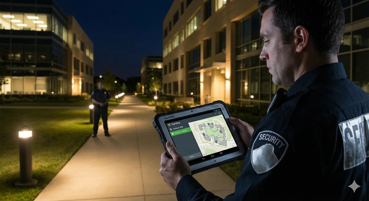
- Patrol verification: Confirm officers visited required areas during their shift.
- Time-in-zone tracking: How long did the officer spend in each area?
- Restricted zone alerts: Immediate notification when someone enters a sensitive area.
- Client-specific zones: Different alert rules for different parts of a property.
Getting Started
Key Takeaways
- Draw fences 20-50 meters inside actual boundaries to account for GPS drift
- Create separate zones for entry points where traffic is expected
- Use time-based rules to distinguish GPS drift from real issues
- Every alert should require action—reconfigure if dismissing most
- Patience during setup prevents frustration during operations
Continue Reading
Video Analytics for Security: Beyond Basic Surveillance
AI-powered video analytics can detect intrusions, count people, and identify anomalies. This guide covers practical applications and integration strategies.
Florida Security Guard License Application: Division of Licensing Guide
Navigate the Florida Division of Licensing application process for security guards, including background checks, training providers, and processing timelines.

The 10 Best Security Guard Management Software Solutions in 2026
From enterprise platforms to mobile-first apps, we review the top security guard software options. Honest assessments of features, pricing, and who each solution works best for.